It seems that summer has finally ended. We had our first snow of the year in Boulder county last week, signaling the official end of warm weather. It is always a tough time of year when I change from shorts and Chacos into pants, boots, and jacket. But it is also a time when I look back on the summer that has ended and reflect on all the new things I have seen and the adventures I have had. This year included more time at Nancy Patterson Village, lots of exploration in Montezuma Canyon, a couple of trips into Grand Gulch, and plenty of time in smaller canyons and on dirt roads across southern Utah. More exploration of Cottonwood Wash revealed many ruins, rock art panels, and a few sets of moki steps. One of my favorite “discoveries”, and it may be just that as I have been unable to find references to it, was a series of stone alignments pointing to Spirit Bird Cave. And as always, there was more climbing around in Comb Wash.
Besides indulging in the archaeology of Utah, we did a “side trip” this year and looked at some very different, and more extensive cultural history. Although it requires another post entirely, which may or may not happen, I’ll at least mention our few weeks in Europe in September, most of it in Croatia. In summary: Roman ruins, defensive positions from the time of the Romans, Venetians, Turks, World War II, and the Balkan war of the 1990’s. There was Split, Dubrovnik, Zagreb, and many cities in between, a week on the Adriatic Sea and visits to many islands including the Isle of Vis, which was a partisan stronghold during World War II and was covered with the history and archaeology of the period, not to mention its Cold War history.
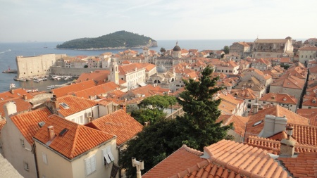
Dubrovnik, Croatia. Far from southern Utah, but an archaeological and historical dream. This view of the city’s rooftops is from the wall surrounding the city looking towards the Adriatic Sea. Many of the roofs are new- a relative term in a city over 1000 years old- having been destroyed by shelling from the Yugoslav Army and Navy during the siege of the city in late 1991.
Stone Alignments
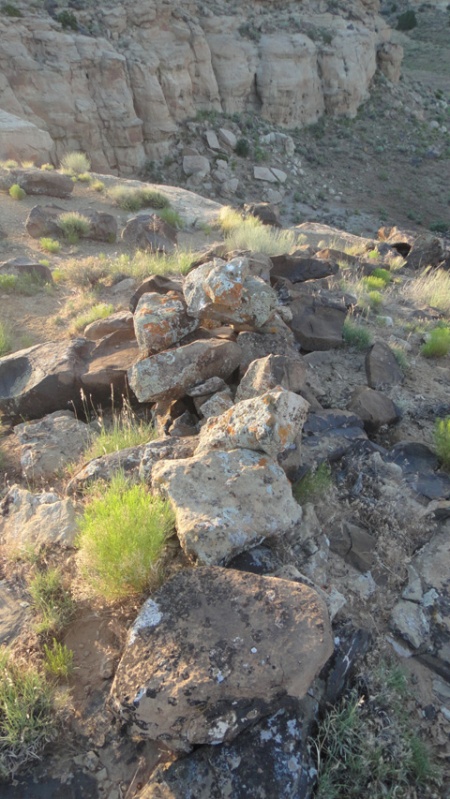
Back to Utah and its stone alignments. I do not recall having found anything quite like these stone alignments before, at least in this area of southern Utah. Of course that doesn’t mean they aren’t out there. They reminded me of Mayan roads we often encountered while working in the jungles of Belize; wide, clear pathways with rocks piled along the margins leading off through the jungle. Inevitably the paths led directly to another ruin. In this case, upon finding the first alignment, I suspected it had something to do with the nearby power lines and the access roads leading up to them. But then I found a corresponding alignment parallel to the first. To make it even more interesting, the next finger to the east had the same alignments, parallel to those on the first. And the third finger, still further east, had more aligned stones, albeit not as neatly done nor as complete as the first two sets. The first two sets had neatly cleared “alleyways” in between the stacked stones, where the stones were likely taken from.
Finally, standing in the center of the alignments looking west brought your eyes directly to Spirit Bird Cave on the rim across the canyon. Not a coincidence, to be sure. And not a “roadway” per se, but more of a ritual or spiritual roadway perhaps, if we accept the importance of Spirit Bird Cave within the context of the local ritual complex.
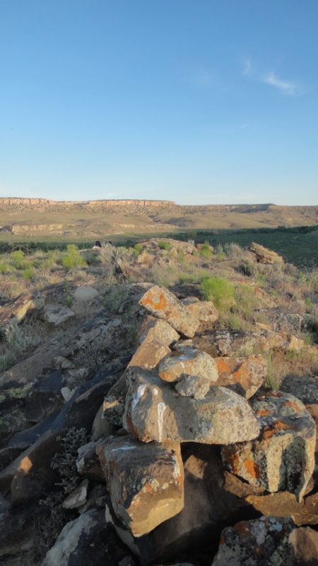
Stone alignment near Spirit Bird Cave, southern Utah. Spirit Bird is on the canyon rim off in the distance, directly in line with the stacked stones. Spirit Bird is slightly higher in elevation than the mesas the three alignments sit on.
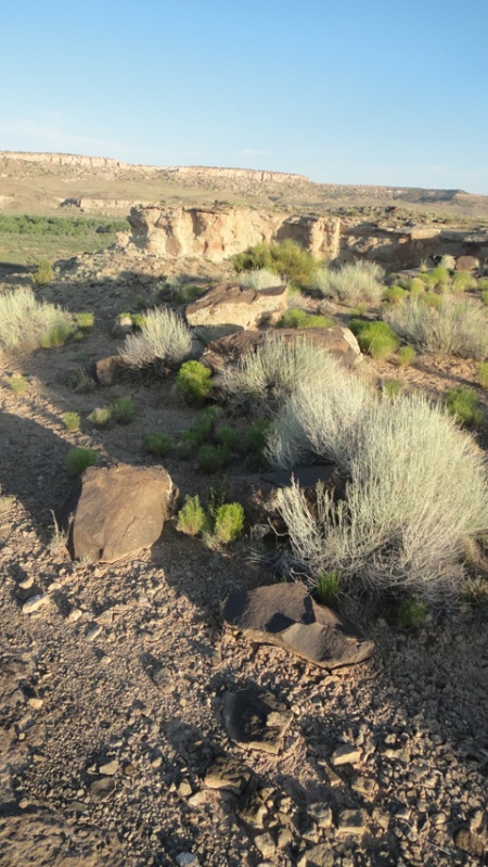
Alignment on the second finger, looking west towards the first finger and Spirit Bird Cave. The azimuth of the stones parallels those on the first finger and points directly to Spirit Bird Cave. This alignment had even larger stones than the alignments on the first finger, but not nearly as many stones in total.
Cottonwood Wash
Cottonwood Wash is an extensive drainage covering more than forty miles from the Abajo Mountains until it meets the San Juan River in Bluff. The drainage is rich in many ways- plants, animals, birds, geology, and of course archaeology. Like Comb Ridge, Cottonwood Wash is a favorite “standby” hike for us. During my October trip I hiked the wash a couple of days at a couple of different locations and as always found more than I bargained for. A number of ruins had the most perfectly faced cut stones I have seen in some time. Not only was the facing perfectly flat and smooth, all the exposed stones in the walls were on exactly the same plane. I expected to find the level and string used in building the walls among the pot sherds.
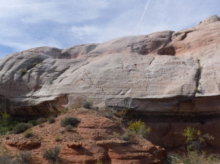
An array of moki steps. For some reason the ancient inhabitants created many ways out of the canyon at this location.
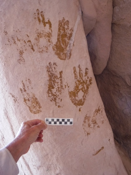
I also happened upon a very large cave with semi-subterranean structures. Unfortunately many of the structures had been dug out by looters, leaving the walls exposed. The cave also contained an array of hand prints- mostly yellow and green, but plenty of red as well.
For more on our desert adventures, an introduction to the flora and fauna of Utah, and links to some of our favorite Utah-related books, visit the Desert Explorer website.


 Posted by desertexplorer